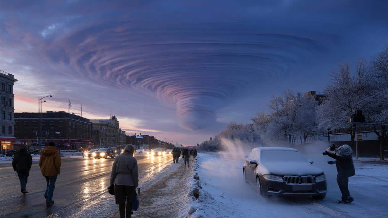
The latest polar vortex split forecast is drawing national attention as meteorologists track significant upper-atmosphere changes that are beginning to influence weather patterns across the United States this February. Recent atmospheric data show a disrupted and elongated polar vortex structure over the Arctic, a development that can lead to colder air pushing farther south into parts of North America.
This evolving pattern comes as forecasters observe stratospheric warming high above the North Pole, a shift that weakens the tight ring of winds that normally traps frigid air in the Arctic. As the vortex becomes distorted, the likelihood of temperature swings and renewed winter storms increases across portions of the central and eastern U.S.
Prepare now for potential cold snaps, snow events, and travel disruptions that may develop as this pattern unfolds in the coming weeks.
What Is Happening to the Polar Vortex?
The polar vortex is a large circulation of strong winds in the stratosphere that spins around the Arctic during winter. When it remains strong and compact, cold air stays locked near the pole. When it weakens or stretches, that cold air can spill into mid-latitude regions, including the United States.
Current upper-air analyses show the vortex in a distorted configuration rather than a tight circular formation. Instead of one consolidated center, the circulation has elongated and shifted, allowing Arctic air masses to move more freely. This type of setup often increases the risk of extended cold periods in parts of the country.
Forecasters note that while a complete and symmetrical split is not guaranteed, the present structure shows clear weakening and displacement, which is enough to alter surface weather patterns.
The Role of Stratospheric Warming
A key driver behind this winter’s atmospheric shift is a sudden stratospheric warming event. During this process, temperatures in the upper atmosphere rise rapidly over the Arctic. As that warming spreads, it disrupts the normal wind flow that maintains the polar vortex.
When those winds slow or weaken, the vortex can wobble, stretch, or divide. This year’s warming episode has already altered wind speeds high above the Arctic, contributing to the current deformation of the vortex structure.
Historically, these events have often been followed by colder-than-average conditions across parts of the eastern and central United States, although the timing and intensity of impacts vary.
How This Could Affect U.S. Weather
The polar vortex split forecast suggests a pattern that favors increased volatility in late-winter weather across several regions.
Eastern and Central U.S.
Meteorologists are watching for renewed cold air intrusions into the Midwest, Great Lakes, Ohio Valley, and Northeast. Arctic air masses may surge southward in waves, leading to below-normal temperatures at times.
When cold air overlaps with available moisture, snow and ice become more likely. Lake-effect snow may intensify around the Great Lakes when frigid air moves across relatively warmer lake waters.
Southern States
While the South typically experiences milder winters, displaced Arctic air can occasionally reach as far as the Gulf Coast. Temperature drops in these regions may be brief but noticeable, particularly overnight.
Western U.S.
The western states may experience more variable impacts. Depending on the positioning of upper-level ridges and troughs, some areas could see milder spells, while mountain regions may benefit from periodic snowfall.
Why Upper-Atmosphere Changes Matter on the Ground
It may seem surprising that weather 10 to 30 miles above Earth’s surface can influence daily life, but the connection between the stratosphere and surface weather is well established.
When the polar vortex weakens:
- Cold air outbreaks become more frequent.
- Temperature swings grow sharper.
- Winter storm potential increases in vulnerable regions.
- Energy demand rises during extended cold periods.
These shifts do not guarantee extreme weather everywhere, but they raise the odds of disruptive events during the heart of winter.
Energy and Infrastructure Considerations
Colder patterns linked to a weakened vortex can strain power grids and heating systems, particularly during prolonged cold spells. Utilities often prepare for spikes in electricity and natural gas usage when Arctic air moves south.
Transportation systems may also face challenges. Snow accumulation, icy roads, and flight delays commonly follow major cold surges. Local agencies typically adjust response plans when forecasts show sustained below-average temperatures.
Homeowners can take simple steps to reduce risk, such as insulating exposed pipes, checking heating systems, and monitoring local advisories during cold periods.
What Forecasters Are Monitoring Now
Meteorologists continue to evaluate:
- Stratospheric wind speeds over the Arctic.
- Temperature trends in the upper atmosphere.
- The positioning of high- and low-pressure systems across North America.
- Ensemble forecast models that simulate multiple possible outcomes.
If the vortex weakens further or separates more distinctly, additional cold waves could develop later this month. If it stabilizes, impacts may be shorter-lived.
Forecast updates over the next one to two weeks will provide clearer signals about the duration and intensity of any cold pattern.
How Long Could This Pattern Last?
Stratospheric disruptions can influence surface weather for several weeks. The lag between upper-level changes and ground-level impacts often ranges from several days to a few weeks.
As February progresses, meteorologists will look for signs of whether the vortex begins to recover strength or remains unstable. A persistent weakened state would favor continued variability in temperature patterns across parts of the United States.
Staying Prepared During a Volatile Winter Pattern
While no single forecast guarantees specific snowfall totals or temperature extremes, staying informed is essential during an evolving winter setup.
Consider these steps:
- Monitor local forecasts daily.
- Keep winter emergency kits in vehicles.
- Check on vulnerable neighbors during cold spells.
- Allow extra time for travel during active weather periods.
Being proactive reduces risks and improves safety during sudden shifts in winter conditions.
The developing polar vortex pattern highlights how interconnected global atmospheric systems shape local weather. As upper-level winds adjust and Arctic air shifts position, communities across the U.S. may experience noticeable swings in temperature and precipitation before winter loosens its grip.
Are you already seeing colder weather in your area? Share what’s happening near you and stay alert for further updates as this winter pattern continues to evolve.